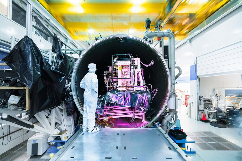
Raytheon, an RTX business (NYSE: RTX), has completed a major test milestone on its latest Visible Infrared Imaging Radiometer Suite (VIIRS) sensor. The VIIRS instrument observes and collects global environmental data that spans visible and infrared wavelengths across land, ocean, and atmosphere and is a pivotal part of the NASA-NOAA Joint Polar Satellite System (JPSS) series of satellites.
The final of the four JPSS VIIRS Sensors, called J4, is in environmental testing and successfully completed Thermal Vacuum tests in late 2023. This milestone was completed ahead of schedule, ensuring that the VIIRS program is on track to deliver the final sensor on time for satellite integration in 2024.
"The recent thermal vacuum testing on J4 was the most successful and efficient cycle in the program's history, demonstrating the team's experience and the collaboration between NASA and Raytheon that allowed for seamless test execution," said Sandy Brown, president, Space Systems for Raytheon.

Market forecast by Region, Type, Application, and End-User. Country Analysis, Market and Technology Overview including Critical Raw Materials, Opportunity Analysis, and Leading Company Profiles
Download free sample pages More informationNASA's Joint Polar Satellite System is the U.S. contribution to the next generation polar-orbiting operational environmental satellite system. VIIRS is one of the instruments on JPSS that consists of 22 bands that provide high radiometric accuracy and spatial resolution multispectral imagery, including the unique panchromatic Day/Night band (DNB), that provide visible and infrared imagery used for fire and air quality monitoring, agriculture monitoring, carbon modeling, flood and sea ice mapping, and other fundamental data products used by the science community. Raytheon has designed, built and delivered four VIIRS instruments since 2010.
Amman, Jordan
Jun 30 - Jul 1, 2026